A once in a generation spring heatwave is rewriting weather records from London to Milan, killing more than a dozen people, and forcing an early start to what forecasters warn will be a brutal summer.
Western Europe is in the grip of something climate scientists are struggling to find words for. A massive high pressure system has locked scorching air from North Africa over the continent, pushing temperatures 10–15°C (18–27°F) above what late May should feel like and the records it is smashing aren’t just new. Some of them have stood since World War II.
Climate scientists are calling the temperature readings “mind bogglingly crazy.” What makes this event uniquely alarming isn’t just how hot it is, it’s that this is the final week of spring.
The pattern driving all of this has a name: a heat dome. And understanding how one works helps explain why this isn’t just an unusually warm week, it’s a sign of where Europe’s summers are headed.
Records That Hadn’t Fallen Since the 1940s
Across the continent, national weather agencies are running out of shelf space for broken records. The heatwave hit countries differently, but nowhere escaped unscathed.
| 🇬🇧 United Kingdom | 🇫🇷 France | 🇮🇪 Ireland | 🇮🇹 Italy |
| 35.1°C | ~39°C | 28.8°C | 35.5°C |
| Two consecutive May records in two days. Previous record of 32.8°C had stood since 1944. | Hottest May day in recorded history. Over 350 stations set new monthly highs. | Five standard deviations above normal. An almost statistically impossible reading for May. | Milan, a northern city known for mild springs hit mid summer levels. |
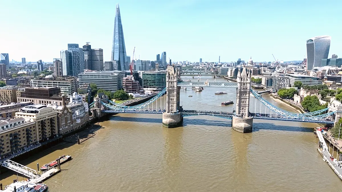
London recorded something meteorologists called an “ultra-rare springtime tropical night” temperatures never fell below 20°C even after midnight. Kew Gardens hit 34.8°C on Monday, only to be beaten by 35.1°C the very next day. In Ireland, Clonmel and Killarney hit 28.8°C, a reading so far outside statistical norms it sits five standard deviations above the typical May average. That’s the kind of number that, in theory, should almost never happen.
In Spain, Portugal, and Italy, where heatwaves are more familiar, temperatures are still steadily climbing toward the 40°C (104°F) mark and the dome hasn’t peaked yet.
What a Heat Dome Actually Does to the Atmosphere
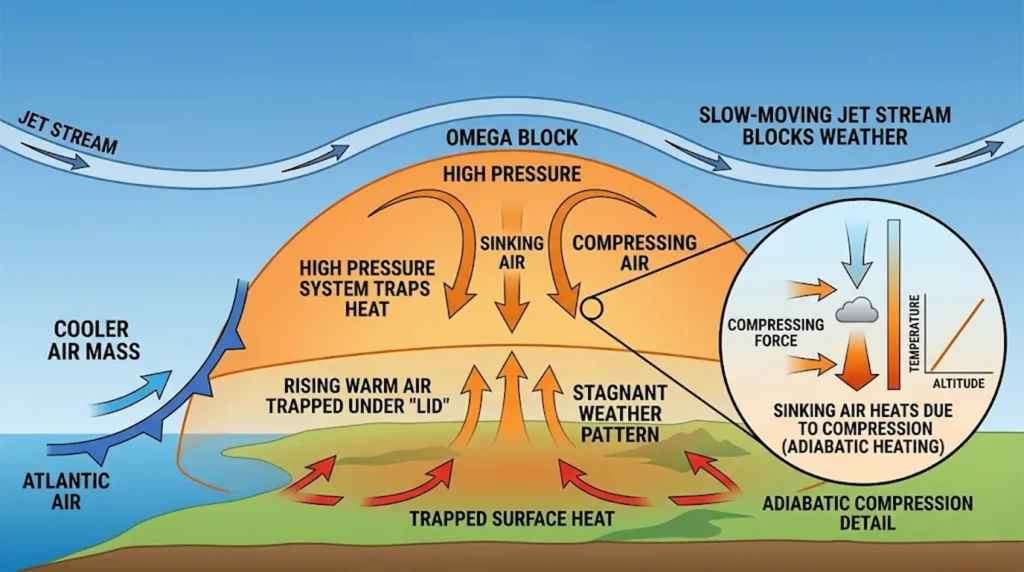
A heat dome forms when a powerful ridge of high pressure gets stuck in the upper atmosphere and acts like a giant pot lid over a continent. Here’s exactly how it turns the sky into an oven:
- The lid forms
A strong high-pressure system builds overhead and forces air downward. Normally, surface heat rises and escapes into the upper atmosphere. The high pressure physically blocks this, trapping the hot air below. - Compression heats the air further
As the descending air is forced back toward the ground, it gets compressed. Compressed gas heats up, a process called adiabatic heating. By the time that air reaches the surface again, it’s significantly hotter than when it started rising. - Clear skies let the sun bake everything
High pressure suppresses cloud formation entirely. With nothing blocking sunlight for 12–15 hours a day, the ground absorbs solar radiation directly and radiates additional heat back upward into the trapped air mass. - The ground becomes a co-conspirator
As heat dries out the soil, a punishing feedback loop kicks in. Normally, some solar energy is used evaporating ground moisture. Once the soil is bone-dry, 100% of the sun’s energy goes directly into heating the air. The dome gets more intense every day it sits. - The jet stream gets stuck
Weather systems normally travel west to east, pushed by the jet stream. When the jet stream develops deep, exaggerated waves, a pattern called an Omega block, the high-pressure ridge gets trapped inside one of those loops. The jet stream flows around it instead of through it, and the dome can stall over a continent for weeks.
“Just two weeks ago, parts of Western Europe were enduring an unseasonal Arctic frost that threatened vineyards. Now, those same regions are seeing record-breaking heat.”
Meteorologists call this rapid swing climate whiplash, the increasingly common phenomenon of extreme weather anomalies arriving back to back with almost no transition. It’s not just uncomfortable. It’s dangerous for ecosystems, agriculture, and infrastructure built for gradual seasonal change.
More Than a Dozen Dead and the Water Is the Threat
Because this heatwave arrived weeks before cities activate their summer emergency plans, it caught populations and services completely off guard. The result has been deadly.
Confirmed fatalities by country
🇫🇷France — at least 7 deaths. Five people drowned in unsupervised rivers and beaches. A 53 year old man died of cardiac arrest during a Paris 10km race. A woman died of hyperthermia at a Lyon fitness event. Ten more runners were hospitalized in critical condition after another race near Paris.
🇬🇧United Kingdom — 5 water fatalities over the holiday weekend. The water itself was still dangerously cold from winter while the air temperature exceeded 35°C, a combination that causes cold-water shock in swimmers.
🇪🇸Spain — A two year old girl died of hyperthermia after being accidentally left in a vehicle in the Galicia region.
The drowning pattern is particularly telling. Lifeguards aren’t stationed at most beaches and rivers until June. When temperatures suddenly hit 35°C in May, crowds rush to the water but the water is still close to winter temperatures. The body goes into shock. That gap between air temperature and water temperature has cost lives this week across two countries.
Beyond fatalities, hospitals across Spain’s Basque Country and western France have reported surges in emergency visits for severe heat exhaustion. The UK Health Security Agency issued its first Amber Heat-Health Alert of the year, warning of heightened risk for the elderly and those with cardiovascular or respiratory conditions. Adding to the crisis, a spike in ozone pollution has formed over Paris and the Rhône Valley, as intense solar radiation reacts with stagnant urban emissions, a direct threat to anyone with asthma.
The Violent Storm Cycle That Follows a Heat Dome
When a heat dome finally breaks down, the atmosphere doesn’t gently return to normal. It releases everything it’s been storing and the result can be more dangerous than the heat itself.
For days, the dome has been loading the lower atmosphere with heat and evaporated moisture from the Atlantic and Mediterranean. When a cold front finally arrives from the Atlantic, a dense wedge of cooler, heavier air it slams into the trapped hot air mass and forces it violently upward. The temperature contrast between the two air masses is extreme, so the warm air rises at explosive speed.
This process, called deep convection, triggers towering cumulonimbus (thunderhead) clouds and unleashes a combination of torrential rain, severe lightning, large hail, and damaging straight-line winds called downbursts. The sun-baked soil, now completely unable to absorb water, turns rainfall into instant flash floods.
Forecasters are already warning that severe thunderstorm alerts will follow for the UK and France once the peak heat begins to slip over the weekend.
When Does It End and Will June Be Any Different?
The dome is at or near its peak intensity right now.
| 🔥 Peak — Wed through Fri | 🌧 Relief — Weekend |
| Extreme temperatures push further east and south. Southern Spain, Portugal, and southwest France approach 40°C. Northern Italy and the Balkans hit the mid-30s. This is the most dangerous window. | The high pressure lid slips toward Central Europe. An Atlantic cold front pushes into the UK, Ireland, France, and Germany. Temperatures drop toward late spring averages but severe thunderstorms are likely during the transition. |
The short answer for June is: more of the same. Seasonal models from the Copernicus Climate Change Service indicate that June is likely to see recurring, pulsing heat events not a single prolonged dome, but repeated waves driven by the same atmospheric pattern.
The reason the forecast is so grim comes down to soil. This heat dome has dried out the ground across much of Western Europe at a pace that normally takes weeks of summer to achieve. Dry soil cannot use moisture to cool itself, which means any future high-pressure system that builds over the continent will trigger intense heat much faster than it otherwise would. The land itself has lost its natural air conditioning.
For the core zone, Spain, Portugal, southern France, and Italy, true summer heatwaves are expected to return in waves throughout June. For the boundary zone, the UK, Ireland, northern France, and Germany, the pattern points to rapidly cycling humid warm spells broken by severe thunderstorms. Not a gradual summer. A volatile one.
This May heatwave hasn’t just broken records. It has effectively skipped spring and dragged an unprepared continent straight into summer and the ground beneath it may not recover until autumn.