
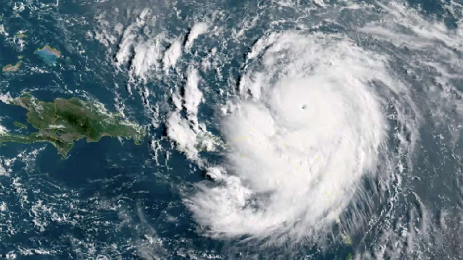
Weather monitors around the globe are tracking the alarming intensification of Hurricane Erin in the Atlantic Ocean, which has explosively grown into a powerful Category 5 storm. In just a matter of hours after being classified as a Category 4, Erin now carries maximum sustained winds of 160 mph (255 kph) making it the first major hurricane of the 2025 Atlantic season and a serious, life-threatening threat to islands across the Caribbean.
Rapid Intensification: A Growing Climate Concern
The rapid strengthening of Hurricane Erin serves as a powerful reminder of the immense, destructive energy contained within these natural systems. Meteorologists are particularly alarmed by how quickly Erin has escalated, a phenomenon known as rapid intensification, which is increasingly linked to warmer ocean temperatures driven by climate change. This type of explosive development leaves communities with dangerously little time to prepare, and poses major challenges for hurricane forecasting accuracy.
Current Location and Projected Path
As of the latest reports early Saturday, Hurricane Erin was located approximately 105 miles (170 km) north of Anguilla, in the northern Leeward Islands. While the storm’s eye is forecast to track just north of the Leeward Islands, the Virgin Islands, and Puerto Rico, its sheer size means that all of these territories will still face hazardous tropical conditions, including high winds, heavy rainfall, and dangerous surf.
Caribbean Communities on High Alert
Tropical storm watches are currently in effect for St. Martin, St. Barts, and St. Maarten. The National Hurricane Center has issued urgent warnings about the potential for life threatening surf and dangerous rip currents along affected coastlines. Forecasters are also raising serious concerns about heavy rainfall leading to flash floods, landslides, and mudslides in vulnerable, mountainous areas across the region.
Puerto Rico and the U.S. Virgin Islands Prepare
Authorities in Puerto Rico and the U.S. Virgin Islands are actively ramping up emergency preparations. Key measures already underway include the closure of seaports, thorough inspections of hundreds of designated storm shelters, and the distribution of sandbags to residents in low lying and flood prone areas. Officials are urging residents to complete their hurricane emergency preparedness plans immediately and follow all guidance from local authorities.
Coastal U.S. Regions Should Remain Vigilant
While current forecasts indicate that Hurricane Erin will eventually curve north-northeast and move away from the continental United States, coastal areas including the Outer Banks of North Carolina and Bermuda should not lower their guard. Even at a distance, a storm of this magnitude can generate dangerous rip currents and powerful surf extending hundreds of miles from the storm’s center, a risk that should not be underestimated.
Stay informed. Residents in affected areas should monitor updates from the National Hurricane Center and local emergency management authorities. Follow all evacuation orders and official guidance.