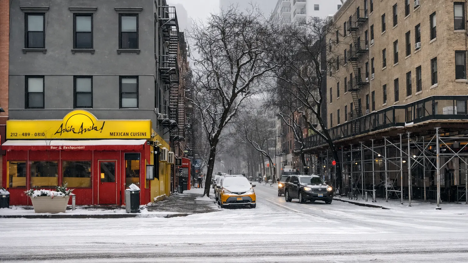
Millions of Americans along the I-95 corridor woke up Monday morning to what officials are calling a crippling winter emergency. A rapidly intensifying Nor’easter officially named Winter Storm Hernando reached peak intensity in the early hours of February 23, 2026, burying major cities under feet of snow and bringing transportation across the Northeast to a near standstill.
Meteorologists have classified the system as a “bomb cyclone,” a term used when a storm undergoes a rapid drop in atmospheric pressure. That explosive strengthening fueled blizzard conditions from the Mid Atlantic to New England, creating one of the most significant weather events the region has experienced in over a decade.
Snowfall Totals: A 31-Inch Reality
Across a broad stretch from New York City to Boston, snowfall totals are ranging between 18 and 24 inches, with some isolated areas surpassing the two-foot mark. Central Massachusetts, including Worcester, and parts of Rhode Island have reported projections approaching 31 inches in higher elevations.
The storm’s intensity was amplified by snowfall rates of 2 to 3 inches per hour, making it nearly impossible for plows to keep up. For hours, whiteout conditions rendered roads invisible, forcing many residents to shelter in place.
Blizzard Conditions and Widespread Disruption
The National Weather Service Blizzard Warnings remain in effect for much of the I-95 corridor, including New York City, Philadelphia, Boston, New Jersey, Delaware, and coastal Connecticut and Maryland. Wind gusts reaching 60 to 70 miles per hour have reduced visibility to near zero in some areas.
Heavy, wet snow combined with strong winds has placed extraordinary strain on infrastructure. More than 250,000 customers from New Jersey through Maine are currently without power, as snow laden tree branches and utility lines buckle under the weight.
Governors in Connecticut and Massachusetts declared
States of Emergency, and commercial vehicle travel bans were implemented along major highways to prevent jackknifed trucks and further gridlock.
A Rare “Classic Snow Day”
For New York City, this storm marks the first official Blizzard Warning in nine years, and the first for Boston in four. In a move that surprised many, NYC Mayor Zohran Mamdani declared a “full classic snow day” for public schools meaning no remote learning, just a complete shutdown to prioritize safety.
Officials emphasized that the combination of extreme snowfall rates and hurricane force wind gusts created conditions too dangerous for routine operations.
Coastal Flooding and Erosion
The storm’s impact has not been limited to snow. A 2 to 4 foot storm surge has caused moderate coastal flooding from Delaware Bay to Cape Cod. Significant beach erosion has been reported, particularly along vulnerable stretches of the Jersey Shore and parts of Rhode Island.
Air Travel in “Total Shutdown”
Air travel across the Northeast is experiencing a state of total shutdown.
More than 7,000 flights have been cancelled nationwide through Monday and into Tuesday. At major hubs such as LaGuardia and Boston Logan, over 80% of scheduled flights were scrubbed.
Airports heavily affected include:
- JFK
- Newark (EWR)
- Philadelphia (PHL)
- Reagan National (DCA)
The storm’s severity has even disrupted international operations. Singapore Airlines, Air India, Lufthansa, Air France, and British Airways all scaled back or cancelled service into the New York and Boston corridors.
What Travelers Should Know
For those with upcoming travel plans, airlines have activated travel waivers, allowing passengers to rebook without change fees or fare differences through later this week.
Travel experts advise:
- Check airline apps first rather than heading to the airport.
- Expect extended customer service wait times (90 minutes to 4 hours).
- Remember that if an airline cancels your flight, you are legally entitled to a full refund to your original form of payment, not just a voucher.
Even as snowfall tapers off later Monday evening, airlines will spend Tuesday repositioning aircraft and crews, meaning rolling delays are likely through midweek.
When Will It End?
The heaviest snow bands are expected to taper off between 5:00 PM and 9:00 PM EST Monday. Conditions will improve significantly on Tuesday, with sunny skies and temperatures climbing slightly above freezing.
By Wednesday and Thursday, a warming trend will push temperatures into the high teens and low twenties Celsius, leading to a rapid snowmelt. However, that thaw could bring its own challenges, including slushy streets and localized flooding.
A Historic Winter Wrap-Up
This storm is being described as a historic “winter wrap up” event, especially following earlier record breaking cold snaps across the country. Meteorologists say it will likely be remembered as one of the defining weather events of the decade for the East Coast.
For now, residents are urged to remain indoors, avoid unnecessary travel, and prepare for a prolonged cleanup effort that could take days if not longer to fully resolve.